Today is going to be a bit rough outside. The heat and humidity won’t be off the charts, but it will be tough if you are working outside. It will also be tough for any after school sports like baseball. Be sure to stay hydrated! Let’s talk about it…
High pressure is offshore with a warm front to our north. We have a cool front that is steadily moving towards us from the west.
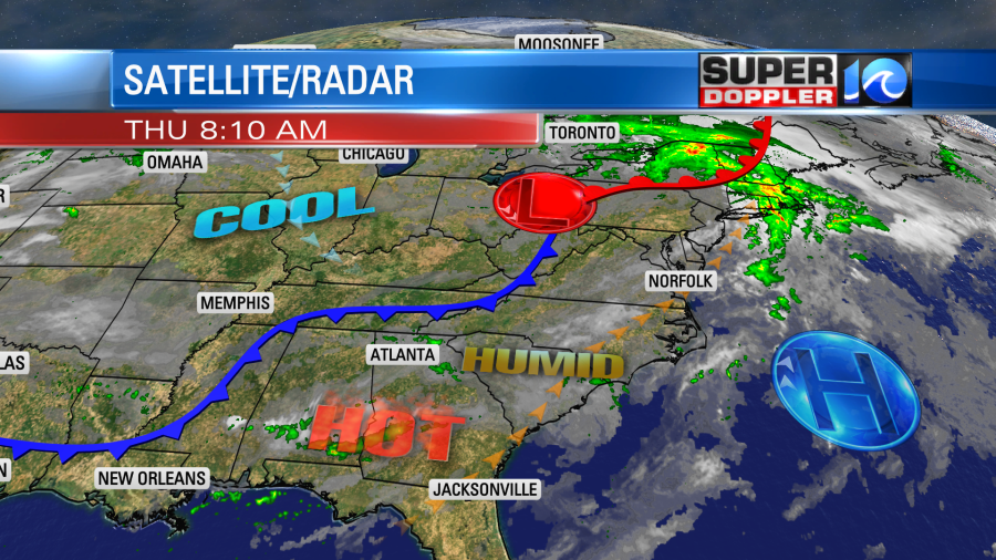
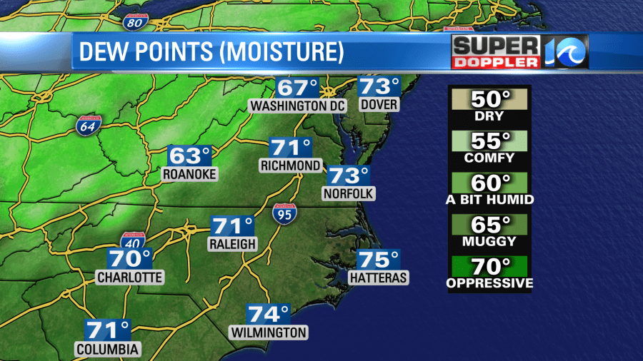
We started this morning with a mix of sun and clouds, temps in the 70s, and LOTS of humidity. Dew points are in the low 70s.
There is a nice breeze out of the southwest, and this should stay with us through the day. It will be out of the southwest then west at 10-15mph with a few higher gusts. However, that same breeze and some sunshine will push the high temperatures up to near 90 degrees this afternoon.
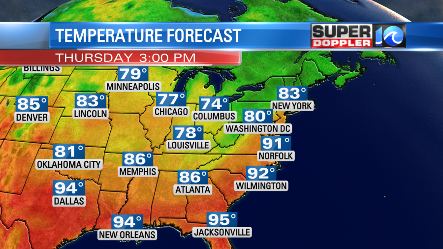
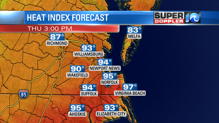
When you combine the humidity it will feel like the mid 90s with a few upper 90s inland.
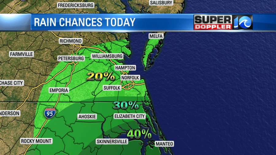
That cool front that I mentioned will move into the region during the mid-late afternoon. Some isolated showers and storms will pop ahead of it in southeast Virginia. However, there will be a few more showers and storms over northeast North Carolina.
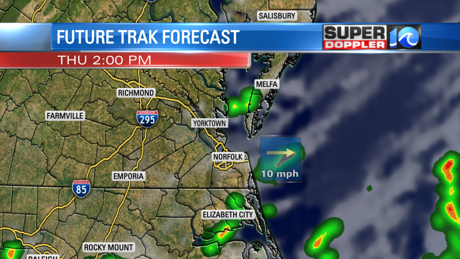
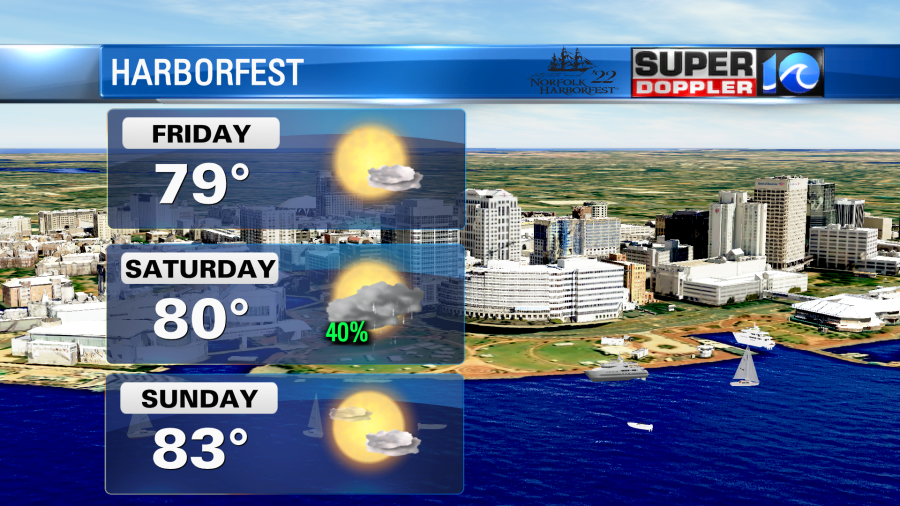
By the late afternoon into the evening we should start drying out as the front sinks to the south. Tomorrow we’ll have some great weather over the region! High temps will be near 80 degrees with drier air in place. We’ll have a lot of sunshine through the day. It should be great weather for Harborfest and for the Parade of Sail.
The Portsmouth Seawall Festival in downtown Portsmouth is also this weekend.
Another system will move in on Saturday. We’ll be warm and humid with highs in the 80s. However, there will be a lot more clouds than Friday. Plus, there will be scattered showers and storms moving in from the west. For now it looks like most of the rain will move in during the afternoon.

I’m not putting my official stamp on the timing for the rain just yet as the timing of many of these systems have been pretty tricky lately. It’s due to that time of year when fronts stall out over or near the region. Let’s just say that, for now, the trend is for the afternoon. High temps will be in the 80s. We’ll be pretty quiet on Sunday with partly cloudy skies. There may be some isolated showers or storms. Highs will be in the 80s. Then we’ll rise to the 90s again on Monday.
In national news…While we are getting some shots of heat here, it won’t be anything like out west. The western and central U.S. are going to see some record heat over the next couple of days. Numerous states will have high temps over 100 degrees.
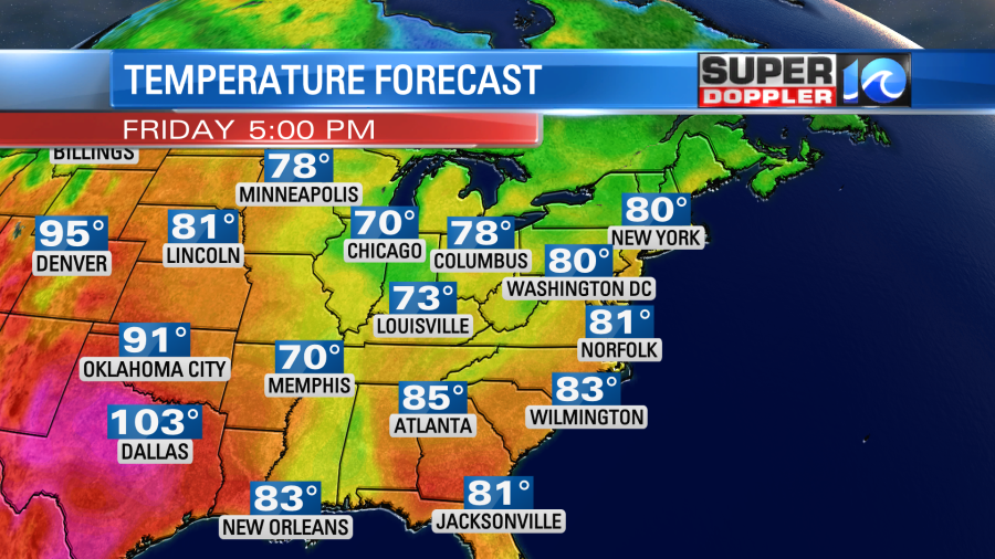
Here is the article with more information: Record Heat in the West.
Meteorologist; Jeremy Wheeler


