About a week ago we were tracking an area of low pressure on the models that we knew would bring us rain, wind, and tidal flooding. We have had impacts (of one type or another) since last Friday. Today will be similar to yesterday. We’ll have more clouds, more wind, and more tidal flooding. However, things are improving very slowly. The wind won’t be quite as strong today, but it will be almost too subtle to notice.
We did drop below the threshold for a Wind Advisory in Virginia Beach and the Eastern Shore. However, winds will still gust above 35mph over the Outer Banks.
The area of low pressure hasn’t moved much since yesterday. However, today it will slowly edge west.
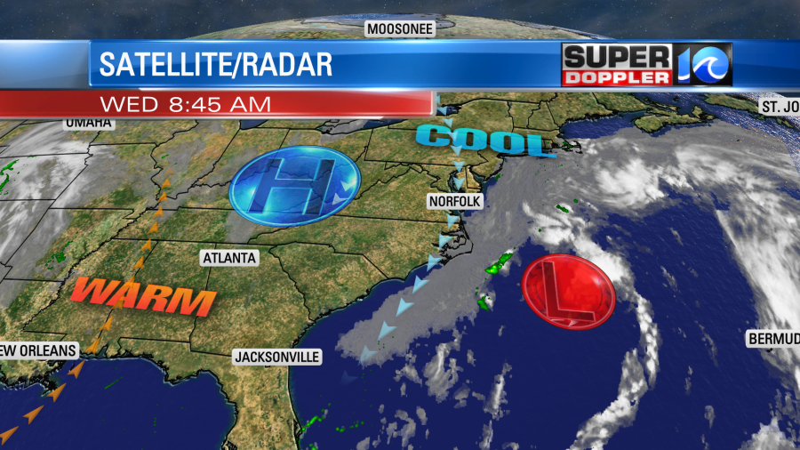
High pressure is still to the west. The low will actually edge to the west today, but it is also weakening. We’ll have lots of clouds through the day with a few peeks of sun. High temps will be near 60. We’ll have some minor tidal flooding during high tide.
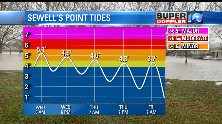
The tidal flooding will be minor over the region later today and tomorrow. It will basically tick down a little during each cycle.
Since it will also be minor over the Outer Banks this should limit the amount of overwash down there going forward.
So by tomorrow the low will weaken even more as it moves onto land (to our south).
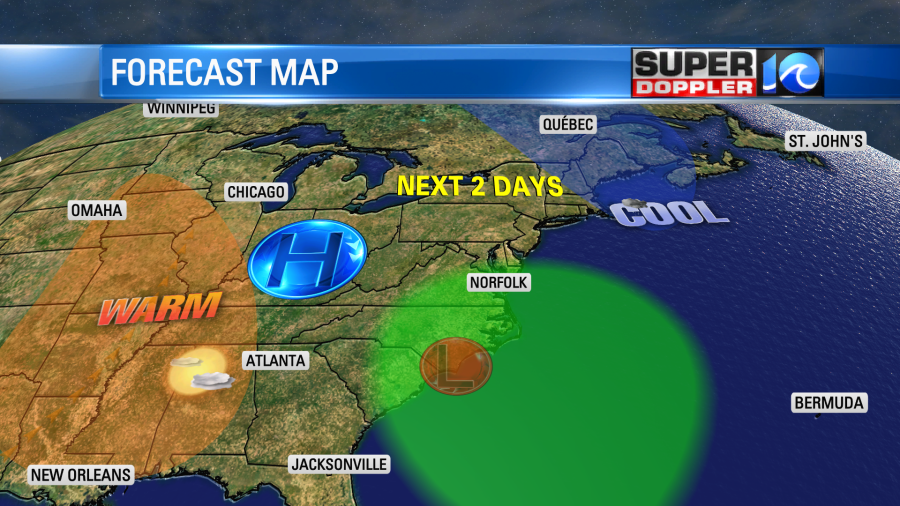
However, the moisture will increase, and the pressure will drop. So we’ll have scattered rain showers in the forecast Thursday. They will be coming in from the ocean, and they will be on and off through the day.
We’ll have a lot of clouds, but the wind will be much lighter and out of the east. So high temps will be in the mid 60s with a few 70s inland. We’ll be even warmer on Friday with highs in the 70s, but there will still be a lot of clouds. Plus, there will be even more scattered rain showers. Rain is likely on Saturday as the energy and the moisture form the low meander over the region. High temps will be in the 70s.
The rain will be good in the long run. We are still in a long-term drought. We did have some nice rain recently, but I’m hoping we get caught up some more between Friday and Saturday.
I am also pinning my hopes on Sunday for some decent weather. For now I see most of the energy and moisture lifting out. So I think we’ll have a mix of sun and clouds with only some isolated showers. High temps will be near 80. Keep in mind that the Euro is still a bit wet. So we’ll see. We have some time to update you on that. Until then cross your fingers for at least one nice day over the weekend.
Meteorologist: Jeremy Wheeler