We had some showers and thunderstorms move towards the region last night. A few areas north and south of the metro had some decent rain and a few storms, but the Hampton Roads are met the 7-10 split and came up short.
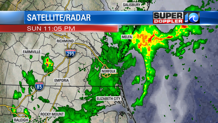
Those all moved out. Then we had a brief flare up around 4:30-6:30am over parts of North Carolina.
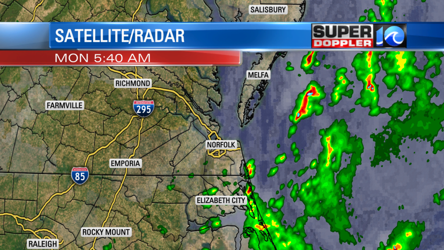
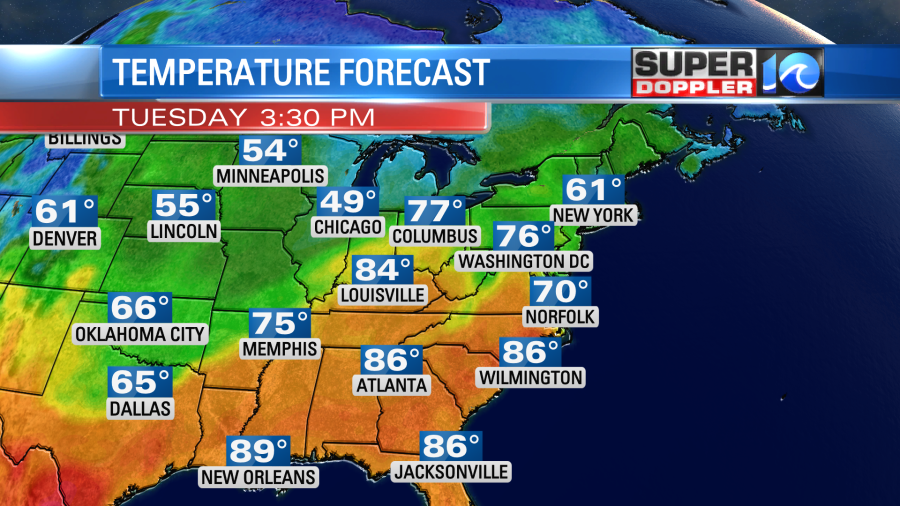
Now those showers and storms have moved offshore. We’ll have quiet weather overall today. We have a warm front to our north with a cold front to the west.
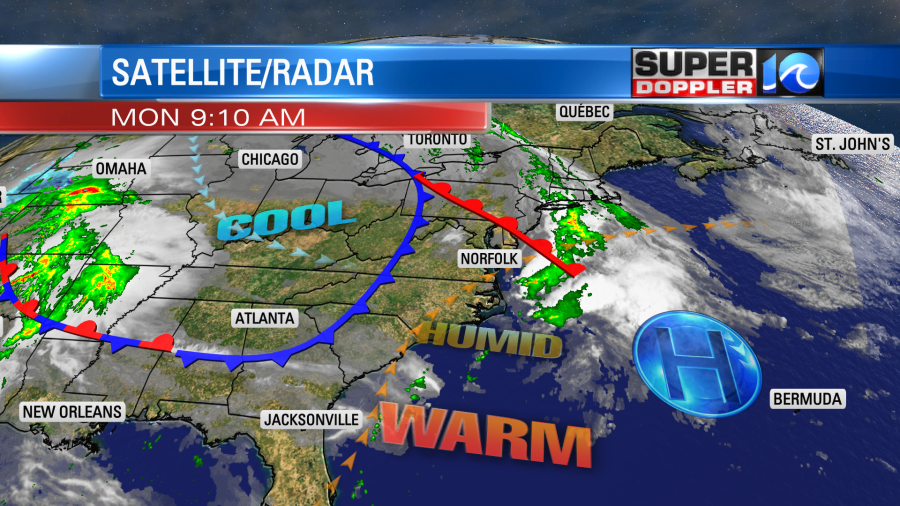
High pressure is offshore. We’ll be partly cloudy today. There will be some isolated rain showers or thunderstorms this afternoon with the heating of the day, but the chance is only 10-20%. It will be warm and humid. High temps will be in the low-mid 80s with some mid 80s inland. Winds will be out of the west/southwest at 8-12mph. It’s good that there will be a breeze because dew points (humidity) have risen up to near 60 degrees. The humidity will be much higher than the last month and a half. We have had some super dry air lately, but it came to a halt over the weekend.
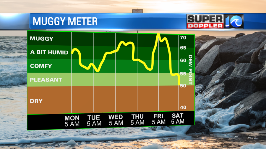
I don’t mind the heat, but I’m not a fan of high humidity. It will stay up over the next few days. In fact we might be downright muggy by Friday.
Tomorrow we’ll have a brief cool down. High temps will get knocked down to the low 70s. Some models are even suggesting upper 60s.
We should have quiet weather during the day again. We could see some isolated showers, but there will definitely be more clouds. We’ll have a northeast wind at 8-12mph. It will likely be a different story during the evening. A warm front will move in from the southwest during that time. So scattered showers and thunderstorms are forecast to move in from the west.

These showers and storms will gradually taper off during the overnight. Then we’ll warm up behind the front on Wednesday. High temps will rise to the 80s again. We’ll have scattered showers with a few thunderstorms. We’ll be up and down some more Thursday into Friday with some more rain chances. However, I won’t go into too much detail on that. If one of the fronts stalls out a little sooner or a little later, then it will change the forecast greatly. So we’ll have an update on the late-week forecast in tomorrow’s weather blog.
In national news…A powerful tornado hit Andover. Kansas over the weekend. There was some incredible video of it. However, officials stated that over 1,000 buildings were damaged or destroyed. Here is the article with more information: Andover Kansas tornado. There was actually a famous tornado that hit there in the early 1990’s. However, that one was a deadly F-5 at the time. Large/damaging tornadoes seemed much rarer back then.
Some other sad news in the same realm. 3 storm chasers recently died in a traffic accident following a storm chase in the same state. They died just south of the state line in Oklahoma this weekend. They were attending the University of Oklahoma. Here is the article with more information: 3 storm chasers die returning from storm chase.
Meteorologist: Jeremy Wheeler