Every snow event that we have in our area is tricky in its own unique way. Since yesterday the models have all trended downward for snow totals for this upcoming event. However, there is still one (the NAM) that is keeping a moderate amount of snow in the region. Overall, the theme is set! We’ll have quiet weather today. The wintry mix changes to snow tonight. Then some snow showers will blow through tomorrow morning. Let’s put it all together.
We start with today’s weather. High pressure has moved off to our northeast. A weak area of low pressure is to our south/southeast. There is a strong cold front swiping through the Midwest.
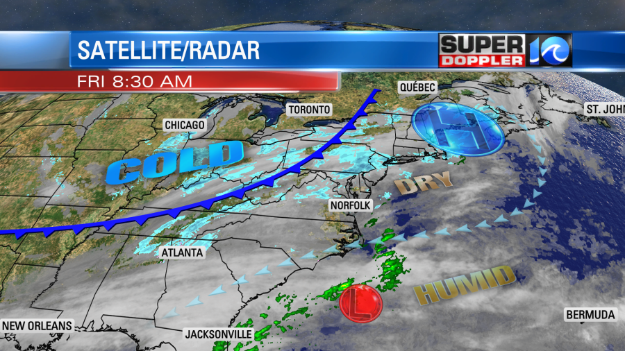
We’ll be mostly cloudy during the day with some occasional patches of sun. High temps will rise to the mid 40s. It might hit the upper 40s if the sun peeks out for a long while. Winds will only be out of the northeast at 5-10mph. As we go through the day the clouds will thicken up. Moisture will increase in the upper levels from the south as the area of low pressure moves northeast and strengthens. There will be a few late day rain showers.
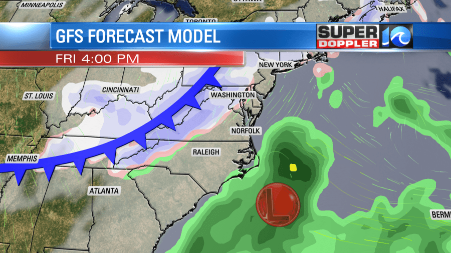
We’ll have an increasing area of a wintry mix this evening. Then as the cold front moves in tonight the mix will steadily change over to snow.
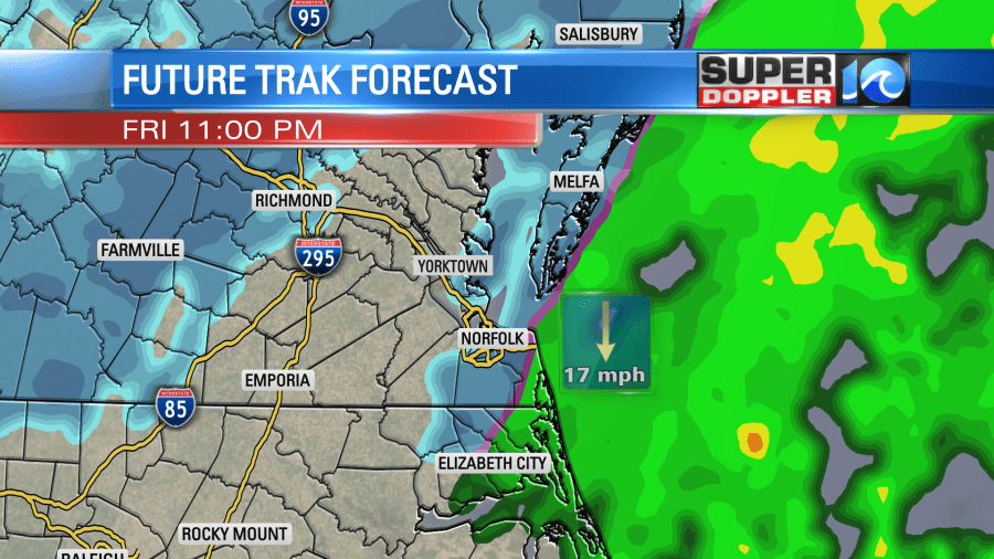
Snow showers will take over and will continue into tomorrow morning. The snow showers will go until at least the mid-morning. Some models keep it going until around midday.
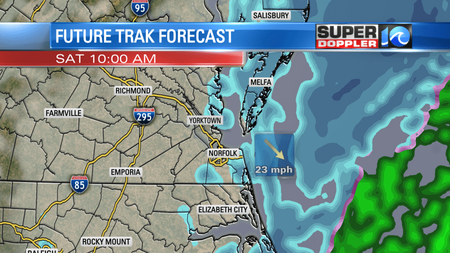
Temps will be near 30 in the morning. However, wind chills will be in the teens and possibly single digits. Winds will be gusting to 35-40mph. So the snow on the ground will likely be blowing around. High temps will only be in the lower 30s Saturday afternoon.
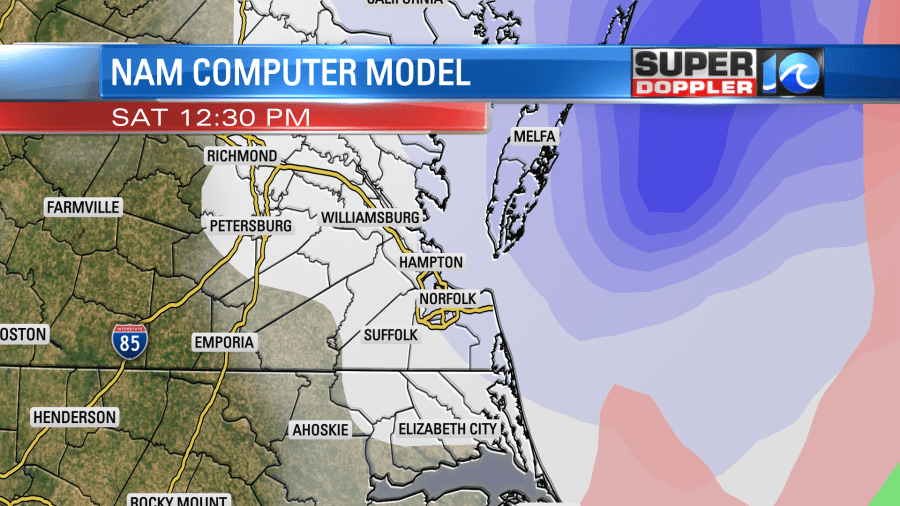
The snow totals forecast would be about a slam dunk if it wasn’t for one model….The NAM. It continues to put down higher totals than the others. I’ve mentioned several times that it doesn’t typically do well with near-shore or offshore weather systems. I’d say in about 1 out of every 6 cases it catches something that the other models don’t. I don’t think that is happening this time. It is basically blowing up the low sooner and therefore closer to our region. Meanwhile the GFS model has also stuck to its guns over the last couple of days. It still has a low amount of snow in the region. That’s 1-2″ with a few inches on the Eastern Shore. Take a look:
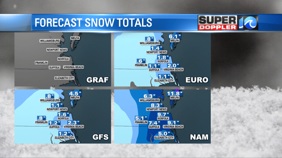
Here is the GRAF model. It was calculating at the time.
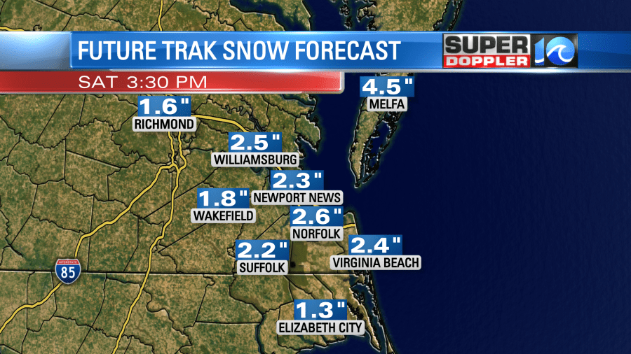
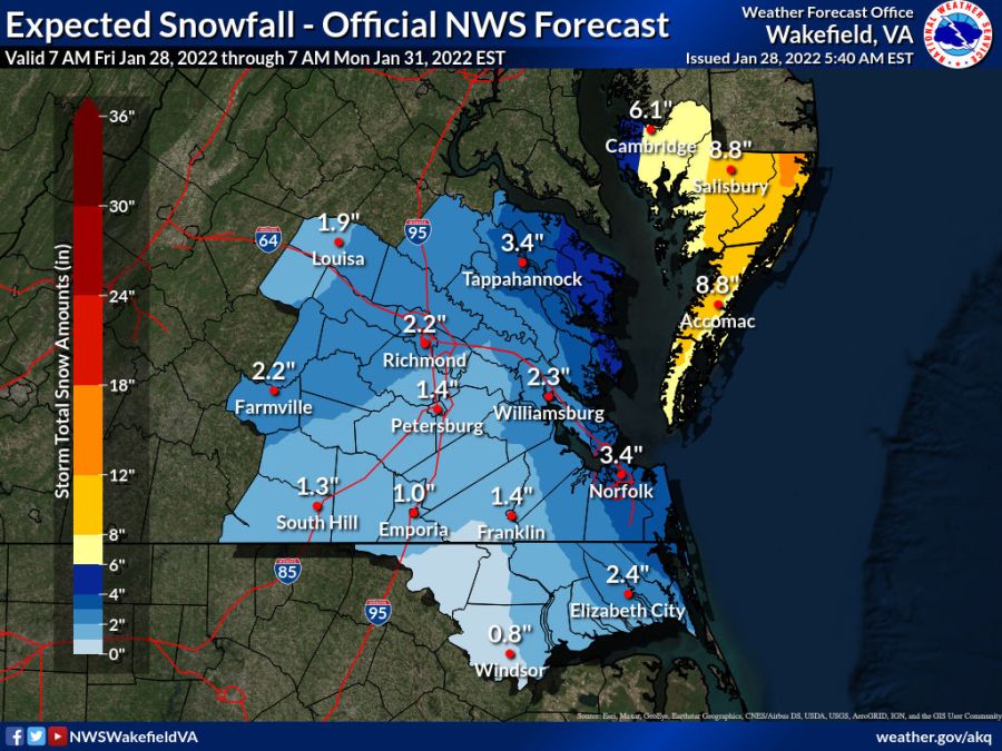
If you’ve been following along the last couple of days, then you will notice that the European model has REALLY dropped the totals. Now it is fairly close to our GRAF model and the GFS. The National Weather Service forecast has gone up and down a little over the past 24 hours. The latest update has actually ticked up a little. Here is their latest forecast (as of this morning):
So putting all of the models together…Here is my snow forecast for the region. Let it ride!
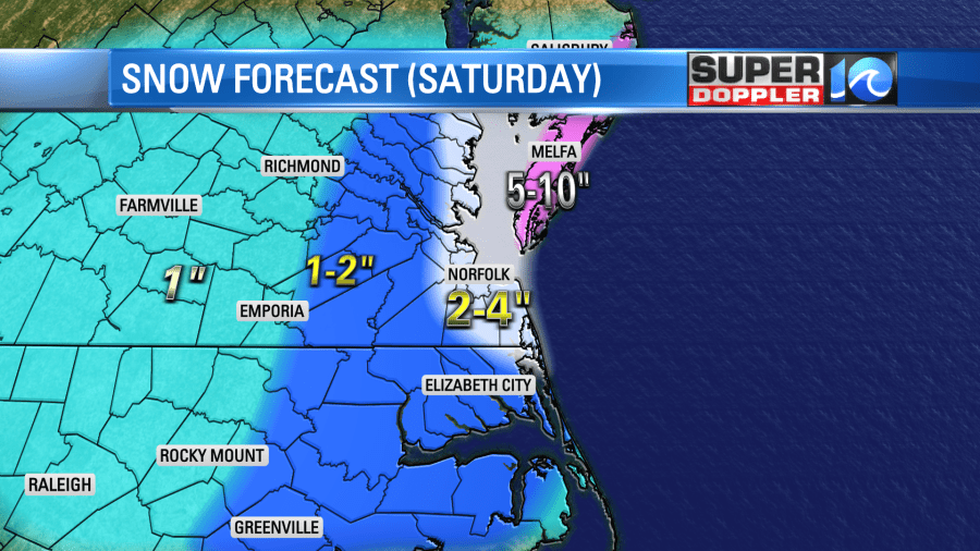
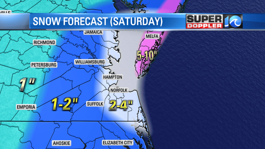
It’s higher than the lower models, but less than the NAM. Place your bets!
One thing is for sure. While we will measure our snow in inches, but they will measure the snow in feet up in the northeast states.
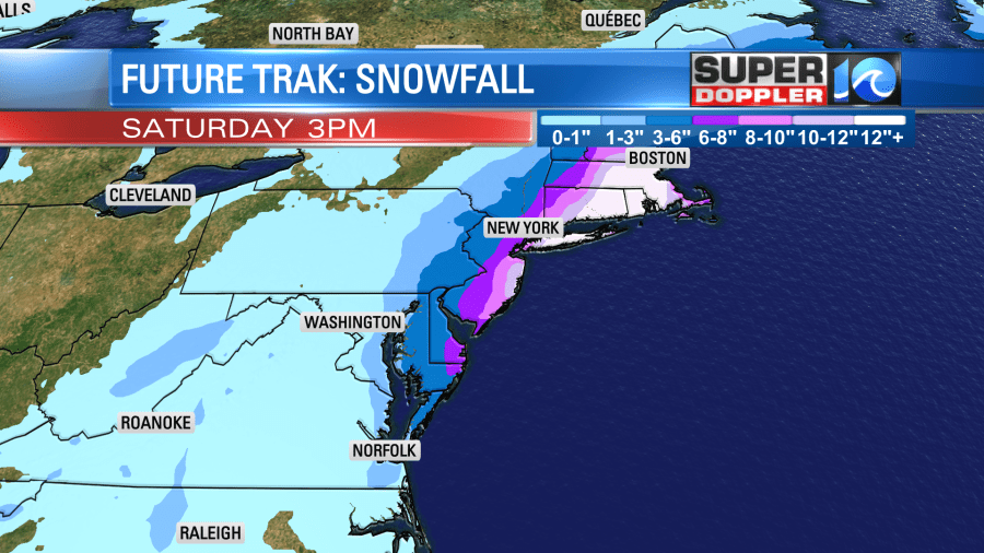
Some forecasts up there are calling for 1-2 (FEET) of snow! Wow! That will not only shut down parts of that region. It could also affect travel in our area. There could be flight cancellations. It could also impact some deliveries.
Around here we’ll have low impacts if we only get 1-2″ of snow. However, travel and business could be hampered if we get 3-5″. Remember too that blowing snow could cause issues in the morning. Whatever snow falls will stick around for a while. High temps will only be in the low 30s on Saturday. It will be in the upper 30s on Sunday.
Speaking of the cold. Low temps will drop to the teens Sunday morning. It might even drop to the single digits inland. It’s been a long time since we’ve had temperatures like those. So cover up your outdoor faucets, winterize your home, and be prepared to slow-drip the faucets.
Meteorologist: Jeremy Wheeler
