Today is going to be the last mild day for a little while. It will be a good time to get out and soak up some sunshine and fresh air. It will also be a good time to do some preps for Winter weather. Time to see if you can find the snow shovel in the shed. Time to get out the ice scrapers and snow brushes. Do you have the salt for the walks? If some models are right, then it might be tough to get around the area late Friday into Saturday morning.
Again, today is fine. We have high pressure in the region with a southwest breeze.
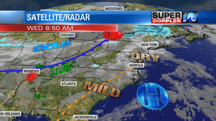
We’ll be partly cloudy with high temps in the mid 50s. Nice!
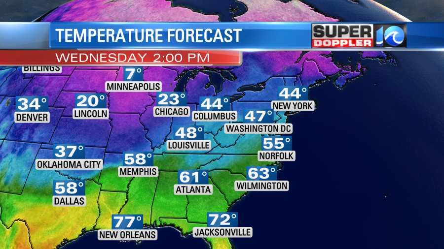
There is a strong cold front in the Midwest. That will steadily work its way down here through tomorrow. We’ll have some rain showers move in during the late morning or midday hours. Temps will be able to briefly pop up to near 50 degrees in the late morning. However, temps will fall steadily through Thursday afternoon.

By the late afternoon into the evening the temperatures north of the metro will fall to the low-mid 30s. In the metro we’ll be falling into the mid-upper 30s. The rain will change over to a wintry mix during that time. The mix will slowly sink to the south.
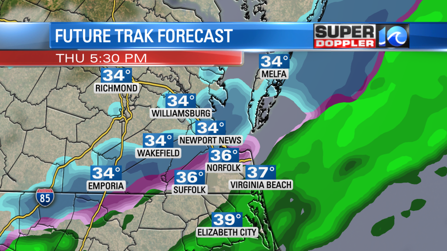
I believe this will have a low impact on the region as a lot of it should melt. Ground temps are still above freezing. The ground will be wet from the earlier rain. Plus, air temps will be likely be above freezing for (most) of the time. I do think we could have light amounts on some grassy areas, but that’s about it. I’d say there’s a fair amount of agreement on that so far. Having said that even rain can slow down the evening commute. If there is any snow then that could distract drivers and lower visibility. Plus, some roads north of the metro could be slick.
Some of the models dry us out Friday morning. The GFS, Euro, and Future Trak all do that. However, the European model keeps the precip going. This is a broad model, and it has the track of a weak low pressure system a little more north than the others. So that may be why. It has been trending south though. So we’ll see about that part of the forecast. Either way all the models bring snow up from the south during the day Friday.
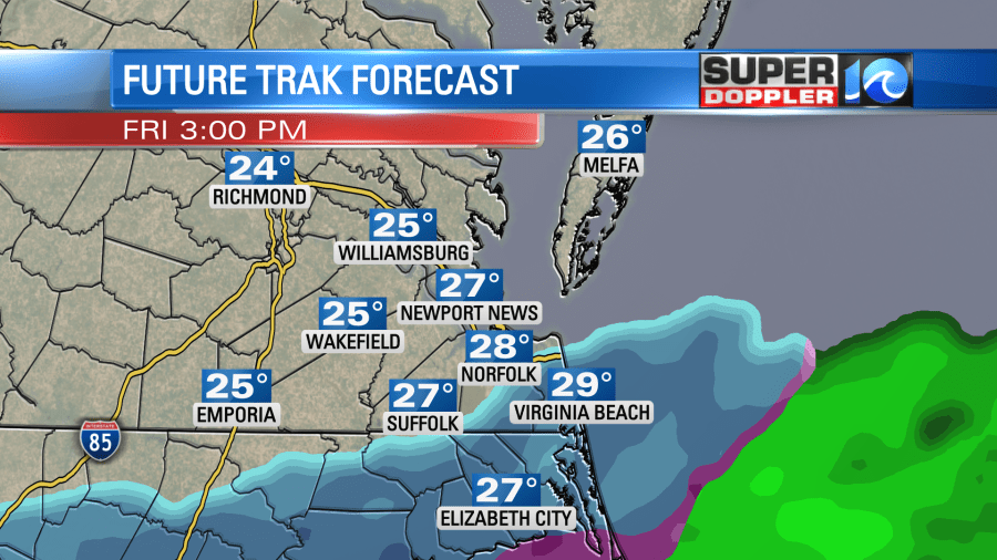
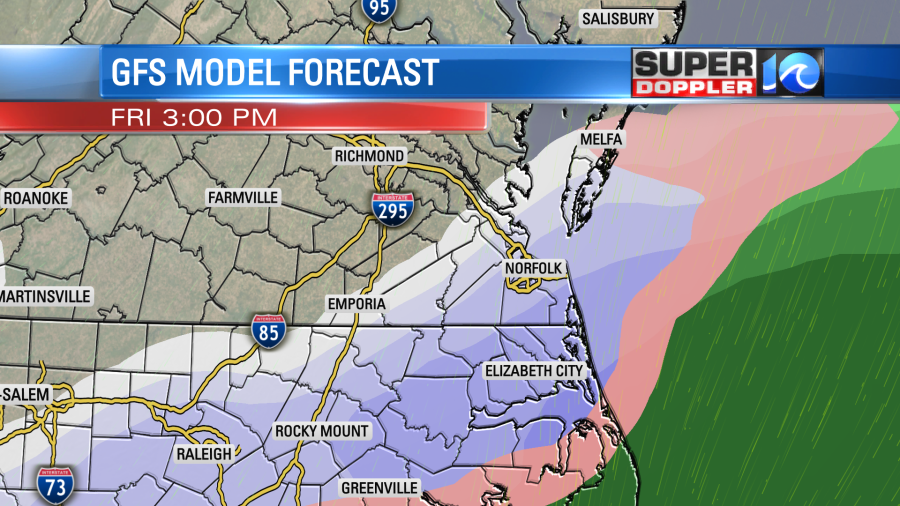
Temperatures are likely going to be in the 20s in the morning and near 30 or in the low 30s in the afternoon. We’ll have a lot of clouds with a strong north/northeast wind. So any snow that falls on Friday will stick. The models keep the snow going into the evening hours with a possible mix near the shoreline and the Outer Banks. Then the models differ on what happens on Saturday. The GFS ends most of the precip by mid Saturday morning while the Euro and the NAM slowly taper it off into the early afternoon.
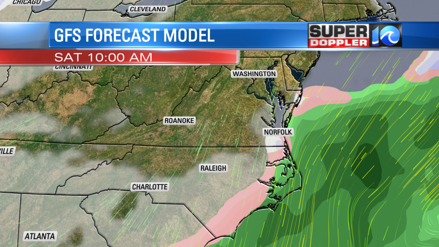

So the models are split on the amounts. The latest European model has the most at this point. It is calling for about 5-10″ in the region.
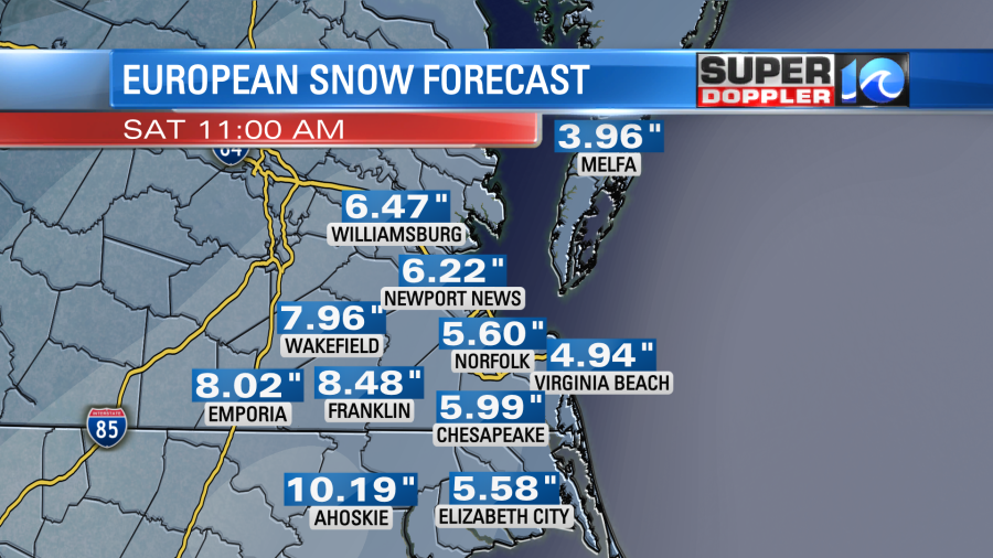
I’ll admit…Sometimes our version of the Euro underdoes snow this far out. However, the GFS model is lower with the amounts.
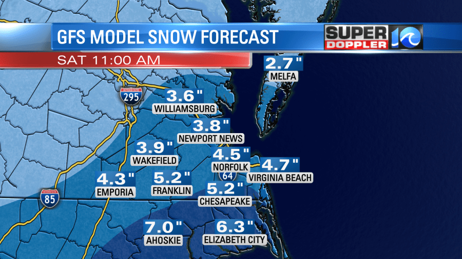
It has a more manageable amount of snow in the region, but even these amounts would impact roads, business, and travel in the area.
Update… I wanted to wait to show the update for the NAM model. The most recent update came in. It has some very high amounts:
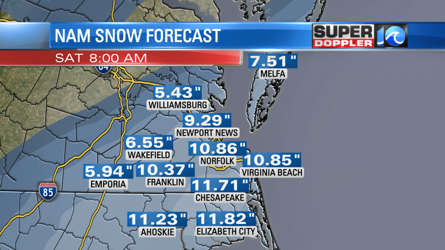
That is a lot! Keep in mind that the NAM model tends to overstrengthen offshore systems. However…on occasion it does actually catch the details of a coastal system.
There’s still a good amount of time for the Friday/Saturday forecast to change. So don’t hang your hat on any exact numbers just yet. I do think the Euro could come down a little, but we’ll see.. I also think the GFS will go up a little. Tomorrow the Friday-Saturday time frame will be more in range of the higher resolution models. So we’ll be able to give a more detailed and confident forecast in amounts.
On top of snow totals, there is a potential for a little bit of ice in North Carolina Friday morning. It could be caused by some brief freezing rain. That part of the forecast still could change as well.
Keep checking back for updates!
Meteorologist Jeremy Wheeler

