Last night when I walked the dog in the evening it was clear and cold outside. Temps had already fallen into the low 30s. However, I had watched the forecast earlier, and I knew that temps would warm overnight as clouds rolled in. They did. So when I came in this morning temps were in the 40s.
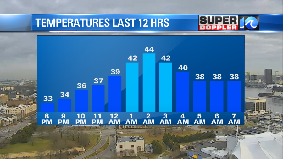
Some scattered light showers moved up from the south during that time. That cooled us down again to the upper 30s due to some evaporative cooling, but at least it was above freezing for the majority of the area.
High pressure has moved offshore. This has allowed the surface winds to turn out of the south. (That already happened aloft last night).
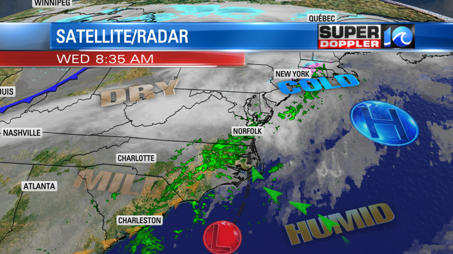
Notice that there is a wind-shift over the Hampton Roads area. There is a southeast wind coming in off of the ocean meeting a light southwest wind over land. As the winds meet together the air piles up at the surface and that pushes upward. (We call this surface convergence in nerdspeak). That rising and cooling air helps to create some rain showers. So as that boundary lingers for a while we’ll have scattered rain showers through the mid-afternoon. They they should taper off by the end of the day.
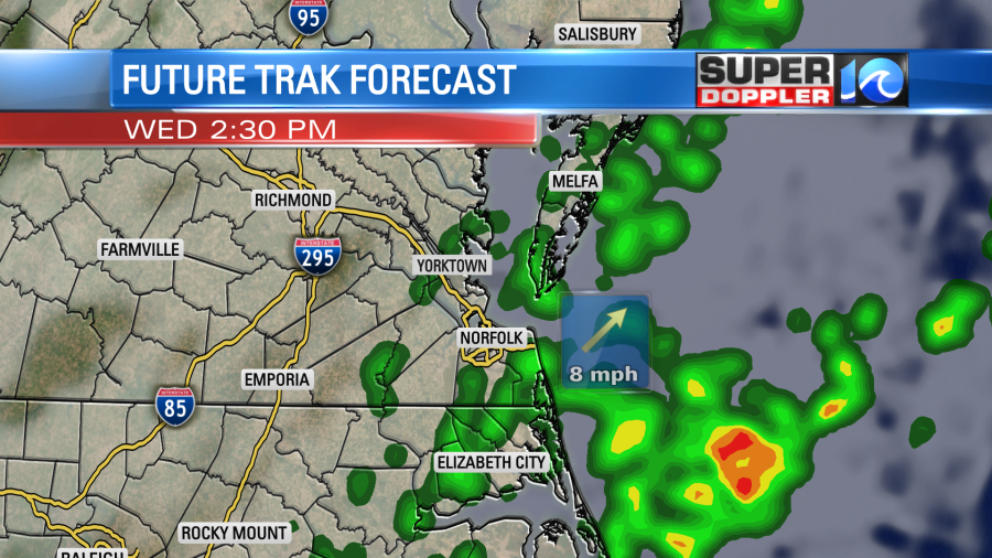
Rain should be light with only a spot or two of moderate. High temps will try to warm to the upper 40s to low 50s this afternoon, but some models keep us in the mid-upper 40s. I’m cautiously siding with the milder numbers for now, but it’s a low confidence.
Tomorrow high pressure builds in again from the west. We’ll have a pretty nice day. Skies will be partly cloudy. High temps will rise to the mid 50s.
By Thursday night into early Friday morning another system is going to move in from the west. There will be a weak surface low along with a fast moving upper-level pocket of energy. This will produce a wintry mix by the early morning hours with some snow north/northwest of Hampton Roads.
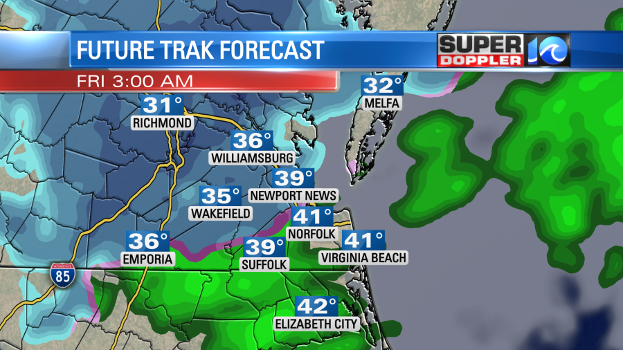
Temps should be above freezing, but it might be close to the freezing mark north of the metro. Temps are forecast to fall some more by 5-7am. The precip could then change to a mix and some brief snow.

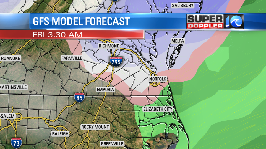
After that point the precip should move out. Now I just showed you one model, but the group of models are in disagreement (surprise, surprise!) about how long the precip lasts and how fast the system moves. For instance…The GFS model has a bigger area of mix and less snow during that same time.
The NAM model really dried up during its overnight run. So here are 4 of those model’s forecasts for snowfall.
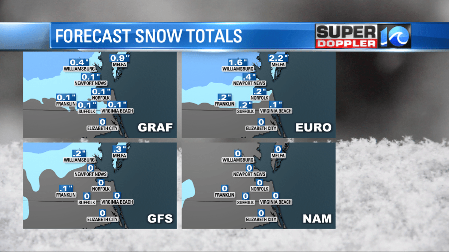
While they do disagree there are some trends. Amounts all look light for our region with possibly some light accumulations north of Hampton Roads. There is hardly any snow forecast for the Southside and northeast North Carolina on all the models shown.
I think the fact that air temps and ground temps will be above freezing will create a lot of melting again. However, the ground isn’t as cold as it was 2 days ago. I’m hoping no matter what this has a low impact on the morning commute Friday, but we’ll have to monitor this closely. Even falling snow that doesn’t stick can cause traffic issues as visibility is reduced, and folks get distracted. Stay tuned for updates!
Meteorologist: Jeremy Wheeler
