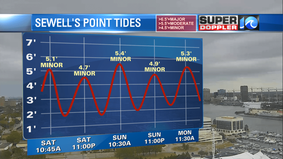
Update: Drizzle and areas of low rain have made their way into Hampton Roads, and that trend will continue through the night. The breeze will slowly back off tonight (still remaining blustery) but then pick back up again tomorrow. Gusts over 40mph are likely, especially for those along the Outer Banks. That’s also where there will be issues with the next high tide cycle (~11am Sunday).
The wind will continue through the night and into tomorrow, picking up the pace as it does so. Gusts along the coastline should easily be over 30mph, with wind gusts up to 40 or 50mph for the Outer Banks. We’ll have to watch the high tides as a result, later this morning and again Sunday morning (~11am). Minor and nuisance flooding is expected for low lying areas around the waterways throughout Hampton Roads. It’ll be more of an issue for the Outer Banks, ocean over wash can be expected with rough surf & seas, especially along Highway 12.
As this system fights dry air, look for some rain to build into the Outer Banks late tonight. Overnight and into Sunday morning, a few showers pull northward into the Southside as temperatures hold in the low to mid 50s. A few of these showers should take us through late morning and early afternoon as most of the rain continues for the Outer Banks. Expect things to taper off on the second half of Sunday, especially by the evening hours.
More dry air moves in by Monday, bringing back the sunshine to the region! Expect a nice stretch of weather next week, too, as temperatures rebound back to near 70° by midweek.
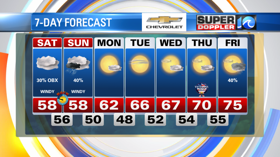
Grab your sweaters, watch the high tides and stay safe this weekend.
Meteorologist Steve Fundaro