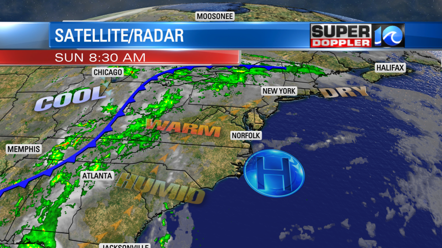
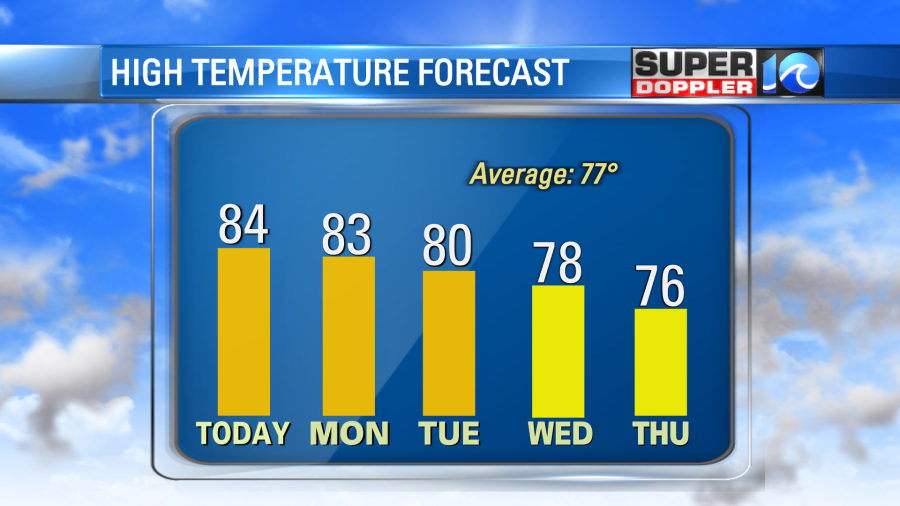
The weather was really great yesterday! We had lots of sunshine, and it was dry and mild. High temps were close to 80 with 70s near the shore. Today we’ll heat up a little more, and we’ll be a bit more humid. High pressure is still overhead, but it’s been situated so that the winds have been out of the southwest for the past 24 hours.
This has created a warming trend that will continue into tomorrow. The high temps today will be in the mid 80s this afternoon. Then we’ll be in the mid-upper 80s Monday. It will be near 80 on Tuesday. We’ll cool down around mid-week.
We definitely need some rain. We ended up pretty dry in July (overall). There were some days with heavy downpours, but lots of breaks in-between. Then we had a wet August. However, the bulk of the rain was at the beginning of the month.
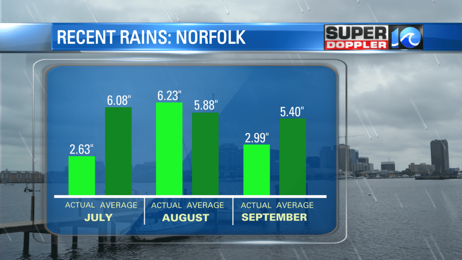
So we had a pretty dry stretch from late August through September. Now we are very dry going into October. We are 5.89″ below average for the year. Tomorrow the cold front will edge closer to us (though it will stay far off to our west). This and the extra moisture could allow for some isolated showers to fall. The front will be closer on Tuesday. We’ll have some scattered rain showers in the region. I don’t think they will be widespread, but that could be our best chance for rain over the next few days. Then we’ll have some isolated to possibly scattered showers later this week. It will be cooler, but it will be muggy for October.
There are still 2 tropical systems in the Atlantic. However, both are weakening, and both will fall apart over the Atlantic. That should happen fairly soon with tropical depression Victor.
The waves from hurricane Sam are decreasing. So we have more of a moderate threat for rip currents today as compared to yesterday’s high threat. Waves will be about 1-3 feet.
Meteorologist: Jeremy Wheeler