I’ve talked to a few folks about the recent temperatures in the region. Some folks asked “How come this Summer hasn’t been too hot?” Others asked “How long is the extreme heat going to last?” When you look at it really there has been a good bit of both above and below average temperatures. Take a look at the last couple of weeks:
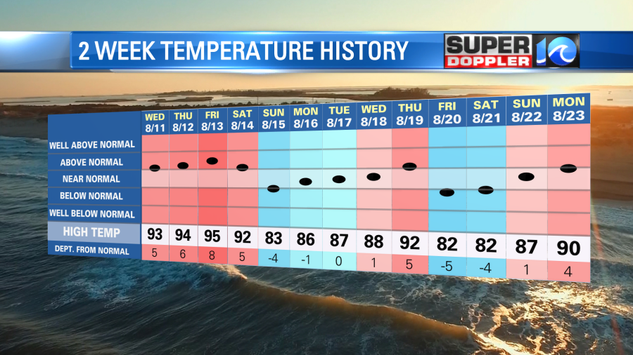
There were several days above average, but also a good handful of below average temps. Early in the month we even had a couple of days with highs in the 70s. That’s rare in August! Then again I looked back over the last 3 years, and there were a couple of cooler days also in 2019 and 2020. When you add up and average out the numbers for the month we are actually running about 1.3 degrees below average according to the National Weather Service. The humidity has been up (even on the cooler days), but it hasn’t been off the charts.
Going forward we’ll have a stretch of above average temperatures, but it will be far from record heat. High temps will be in the low 90s here today. They will be in the 90s and 100s again in the central U.S.

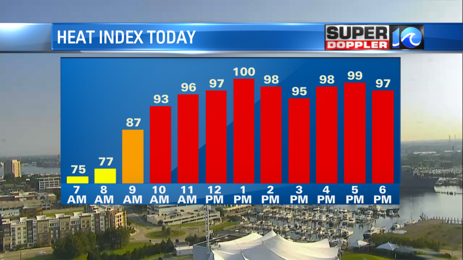
Our heat index will be near 100 this afternoon.
We do have high pressure near the area. However, there is also a very subtle wind shift over the region.

This will probably kick off a few showers and storms this afternoon. The rest of the week looks quiet, hot, and humid with high temps in the low-mid 90s. The heat indices will be between 99 and 104. It may be higher in some inland locations. At least the weather looks pretty quiet for the rest of the week.
The tropics are quiet for now, but there are 3 tropical disturbances that are in the Atlantic basin.

The 2 features in the Atlantic will probably stay out to sea, but it’s still early to be too confident in that. However, the disturbance in the eastern Caribbean could possibly form and get into the Gulf of Mexico over the next few days. Stay tuned for updates.
Meteorologist: Jeremy Wheeler
