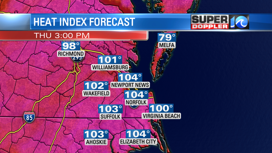
Yesterday it was hot even in the shade! Luckily there was a light breeze at times, but the heat was rough. High temps made it into the low-mid 90s. The heat index was over 100 for many. Today temps will aim more for the mid 90s. The heat index could be up to 106 degrees. That’s why we’re on day 2 with the Heat Advisory. However, today it covers the entire viewing area.
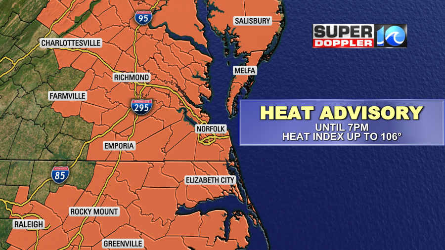
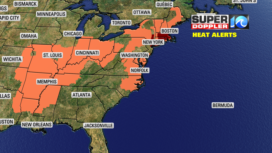
It goes until 7pm. We are not alone. Millions of people are under some type of heat alert today across the U.S.
High pressure is centered offshore to our southeast. There are no big weather systems nearby.
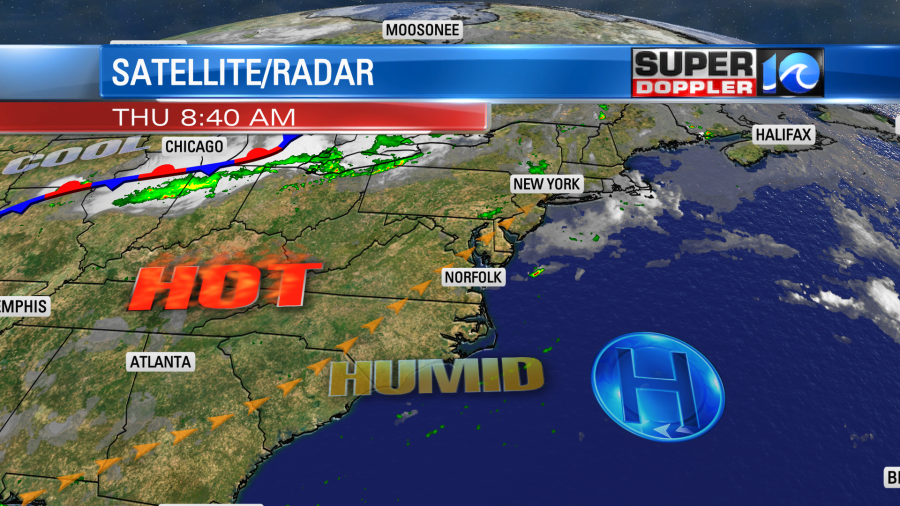
The “Bermuda” high will sit over the western Atlantic for a couple more days. We’ll be mostly to partly sunny today. There will only be a stray shower or storm during the day, but some isolated showers/storms are possible this evening as they drift over from central Virginia. Again high temps will run up into the mid 90s this afternoon. The heat index will be over 100 for many.
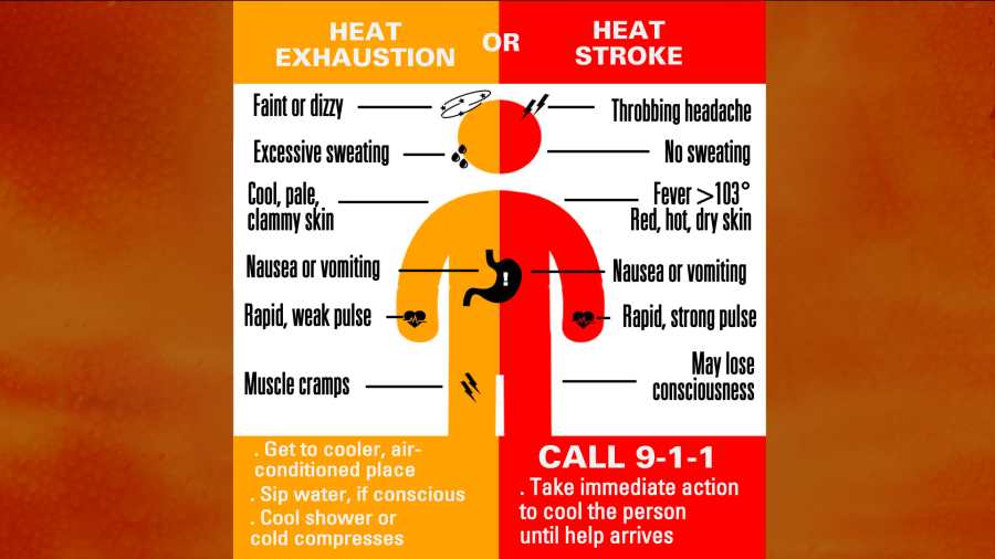
Since we have a Heat Advisory for the area it is worth reminding folks about some things to beat the heat:

There are a couple of types of “heat illness”. I’ve had heat exhaustion before, but I’ve never had heat stroke. However, there was a man that got heat stroke once when I was doing labor up in Illinois. We were working on a roof, and the fire department had to come and take him down a ladder. Here are some of the symptoms for both illnesses:
Tomorrow we’ll have similar weather. High temps will be in the mid 90s again. The heat indices will be between 100 and 106. We’ll be partly sunny with some isolated pm showers and storms.
By Saturday a cool front will move into the region. It won’t move in until later in the day. So we’ll have an increase in clouds. There will be some scattered showers and storms developing. High temps will probably reach the upper 80s to around 90 degrees before the cool down arrives. The front will stall out just to our south on Sunday (probably). We’ll have a mix of sun and clouds with scattered showers and storms. It will finally feel cooler with high temps in the lower 80s and lower dew points. We should stay cooler through early next week.
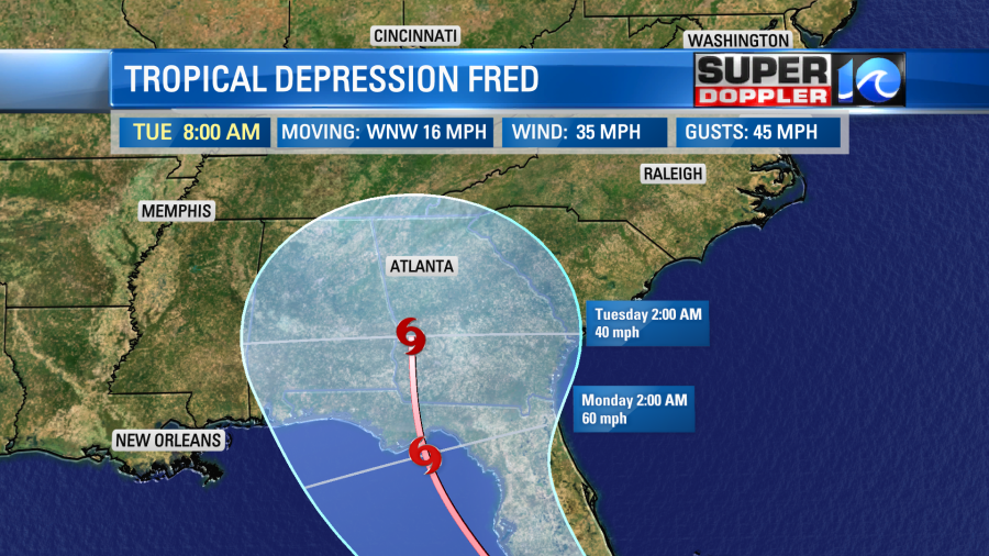
Overnight Fred weakened to a tropical depression. The higher terrain of Hispaniola chewed it up and weakened it. The satellite this morning barely showed any activity near the center.
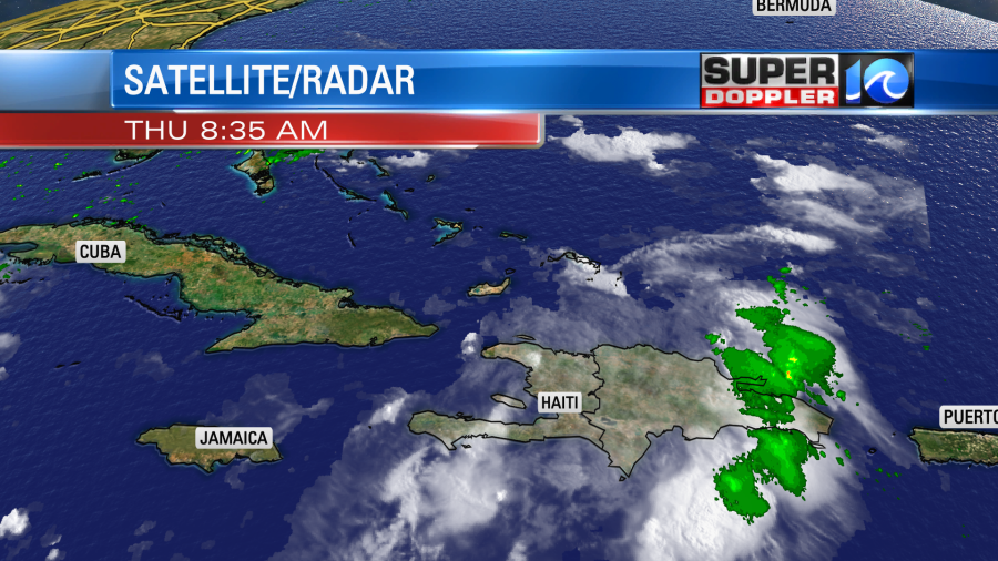
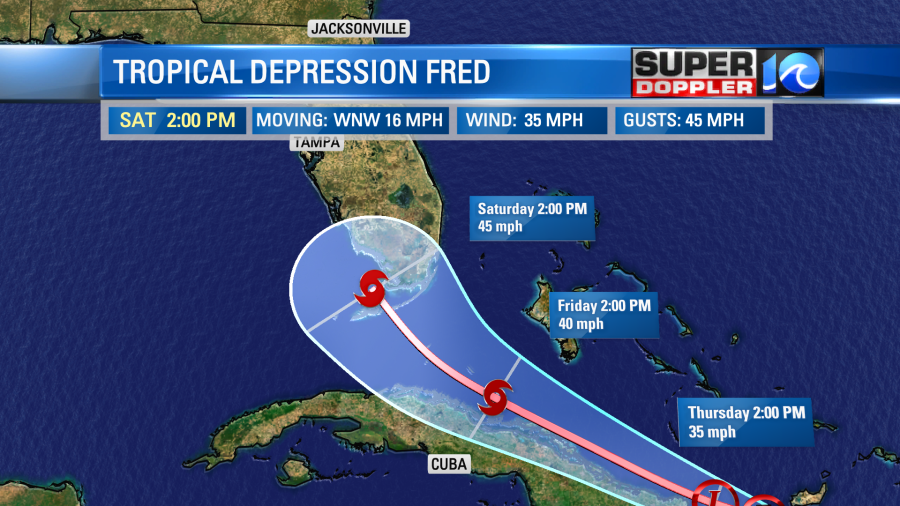
However, the center is back over the water. Now it will slide to the west/northwest along the northern coast of Cuba. The amount of land interaction will determine how soon and how much it restrengthens. This means that it could be anything from a weak tropical depression or a healthy tropical storm as it approaches the Florida Keys Saturday.
Due to the variance in the forecast strength there is a lot of uncertainty in the track after that point. Some models have it going up through Florida. Some have it going more west in the Gulf of Mexico. The latest consensus is off the coast of Florida over the weekend.
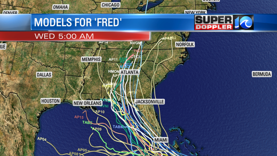
The official track follows the consensus closely. It then takes it up through the Florida panhandle into southern Georgia.
The Euro is kind of close to the most likely path (center line above). However, it runs Fred right over Tampa at one point.
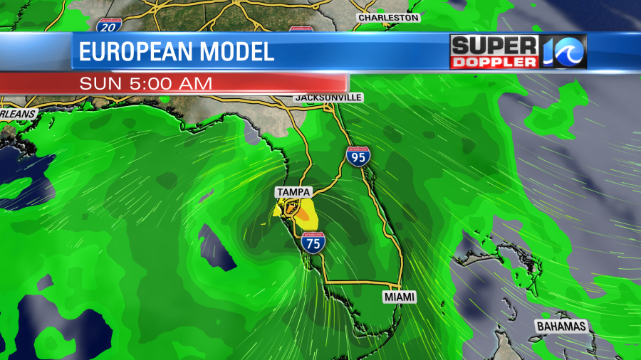
Then it has heavy rain moving up into the Appalachians around the middle of next week. The GFS track is more to the east now, but that keeps the system over land for a long time and very weak. It has it basically falling apart over the southeast states. However, that model also has a lot of rain across a big portion of the Southeast for at least 2 days.
So we’ll keep an eye on Fred. There is another tropical disturbance over the central Atlantic. It is moving to the west.
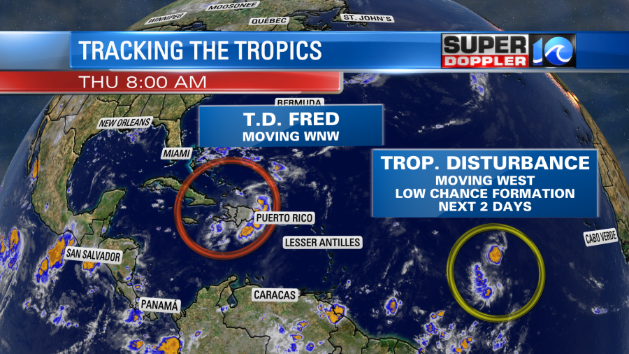
This has a low chance of formation in the next couple of days, but a moderate chance in the longer term.
Meteorologist: Jeremy Wheeler