
After a nice little stint of some quiet, pleasant weather, the humidity returns to Hampton Roads and with it a round of showers and thunderstorms. These will likely be Monday afternoon and some of which could be on the stronger side, so be sure to stay weather aware.
A few showers and thunderstorms to our northwest are slowly approaching as we finish the weekend. But locally, we’ll be pretty quiet through the rest of Sunday. A few more clouds stream in from the northwest and there could be a stray shower or two late tonight, but we’ll hold of on those more notable rain chances until Monday afternoon.
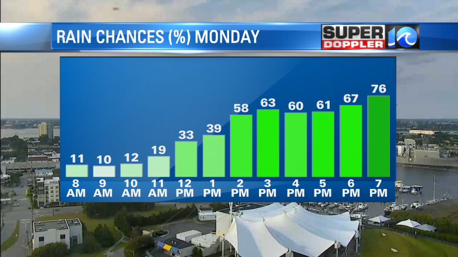
Another (kind of unusual for July) front is approaching and will slowly drop through the area tomorrow. So as we start the workweek Monday morning should feature a nice sunrise with temperatures near 80°. The humidity will be present with a warm breeze taking us into the early afternoon as highs get near 90°. We’ll then notice showers and thunderstorms develop across the area which will likely increase through the afternoon and evening commute as they push south.
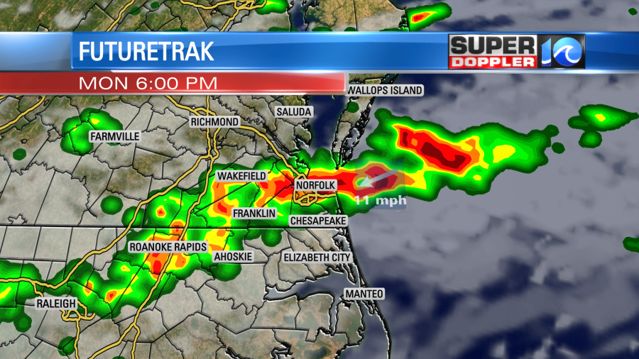
Some of these could be on the stronger side, so be sure to remain weather aware and keep an eye on the WAVY Weather App. Downpours and lightning of course, but strong, potentially damaging wind gusts, would be the concern.
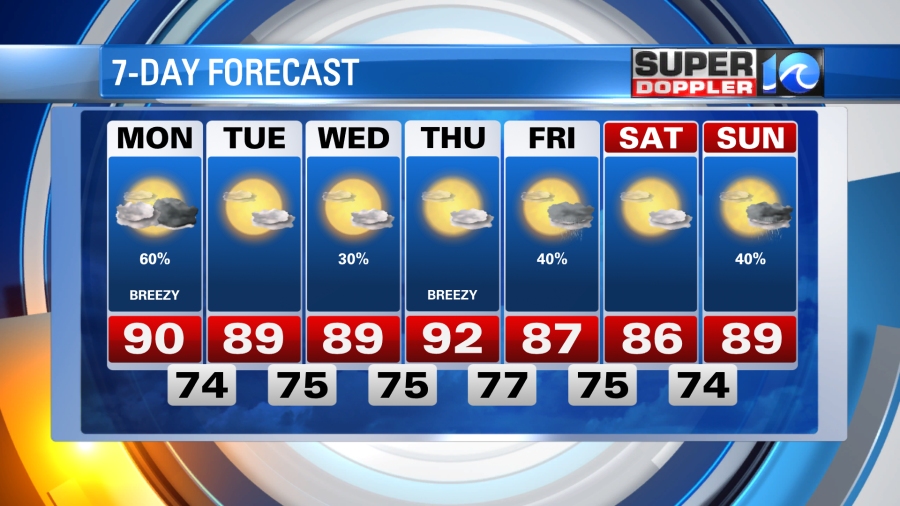
The front should push to the south enough to clear us out and provide increasing sunshine on Tuesday, however the humidity and summer temperatures should stick around. Highs remain near 90° through Tuesday and much of the upcoming workweek. There could be another round of rain towards the end of the week as well.
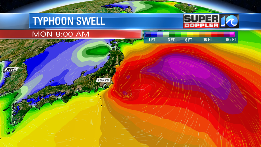
Tropically speaking, things remain pretty quiet in our part of the world. But over in the western Pacific, it’s a whole different story. A tropical cyclone is making an approach on Japan over the next 48 hours. The bulk of the wind and rain should remain north of Tokyo, but some Olympic events have already been impacted/rescheduled.
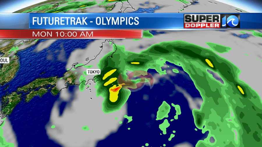
One event that is benefiting from this is surfing. There was some skepticism – and maybe worry – that surfing’s Olympic debut may be a bit underwhelming. The location of the competition – Shidashita Beach, about 40 minutes east of Tokyo – is not known for eye opening, jaw dropping waves like you’d see in Hawaii or South Africa. So just like here on the East Coast during hurricane season, a building swell from this tropical cyclone will provide more action in the waves.
Stay stoked! – Meteorologist Steve Fundaro


