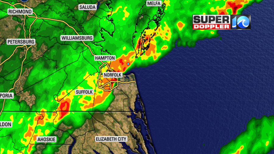
Heavy rain moved into Hampton Roads this morning. It made for a messy morning commute for some.
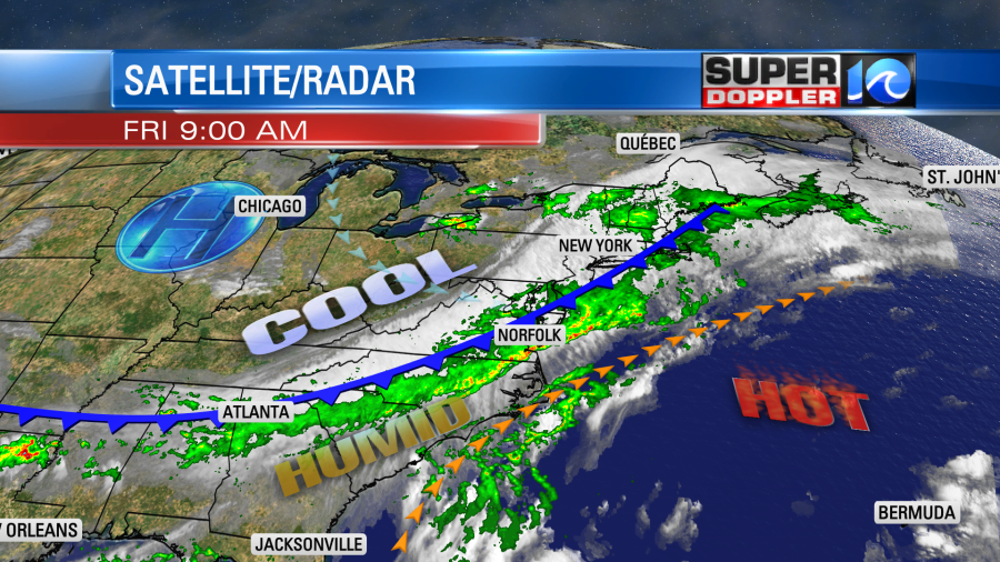
This is from a slow-moving cool front that is sinking south into a tropical air mass.
The rain will be heavy at times this morning, but the showers will become more scattered during the afternoon.

Winds will be out of the southwest and west at 5-15mph. There will be some higher gusts near the shore. Temps will be in the 70s most of the day, but they may briefly reach up to 80 this afternoon. We will see about 0.5″ to 1.5″ of rain over much of the region, but there will also be some locations that will see 2 or more inches. Some already have.
The cool front will drop to the south by this evening. We’ll have a few showers and isolated thunderstorms early. Then we’ll have some clearing later tonight. The rest of the weekend looks good. We’ll be partly cloudy with only a stray shower or storm in the region. Highs will be in the 80s Saturday and Sunday. We’ll be in the low 90s on Monday. The humidity should stay down through that time.

We’ll have quiet weather early next week, but later in the week depends on what happens with Elsa.
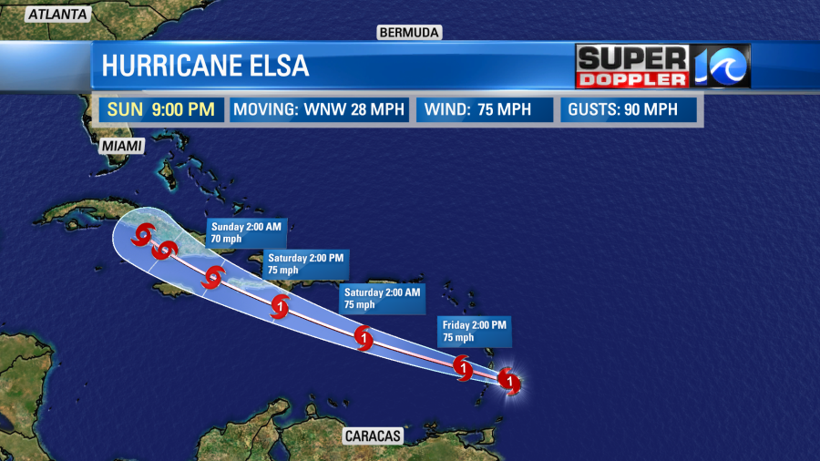
This morning Elsa strengthened into a hurricane according to the National Hurricane Center.

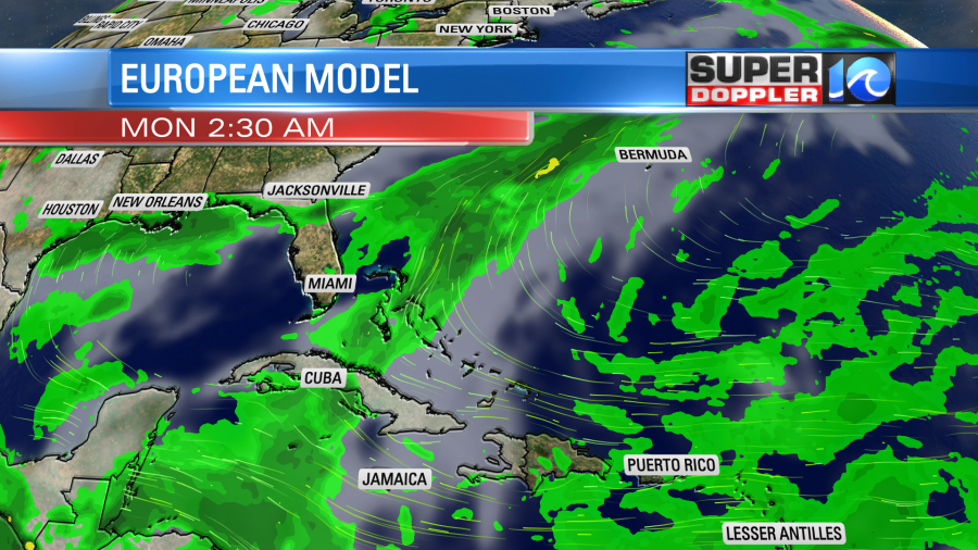
The system will cross the Lesser Antilles this morning. That could briefly weaken the system. However, it is moving fast. So it won’t interact with the islands very long. It is over warm water, but there is some wind shear. The system is forecast to weaken as it moves near or over Haiti, Jamaica, and Cuba. There is a good deal of confidence in the forecast up to that point.
However, after that the confidence drops sharply. The models are very split as to what they want to do after Cuba. Some models take it west into the Gulf of Mexico. Many models run it up into south Florida. There are a few which take it northeast up the east coast.
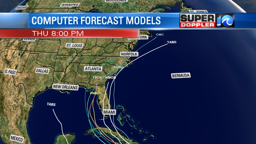
Then there’s the Euro model which actually dissipates the system in about 3-4 days.
It’s tough to say which model is more accurate, but I’d say that the models that have it stronger in the short term may have a better handle down the road. It’s tough to figure that out because the hurricane strength is already above all the guidance. Anyway, the National Hurricane Center is splitting the difference between the model spread. They have it running up into southern Florida early next week. They claim a low confidence in the 3-5 day forecast due to the huge model spread.

We’ll follow the system over the weekend and bring you updates. Otherwise enjoy the weekend and the 4th of July!
Meteorologist: Jeremy Wheeler