Well, I’m back from my trip to Illinois. I had a good time. Got to visit with some family that I haven’t seen in a while. Had some Chicago style pizza! The real deal. It was actually very humid up there with a lot of rain. I returned Monday to a hot and humid air mass here. Yesterday wasn’t any better. It was in the low 90s, but the heat index was near 100. Since I wasn’t here for a few days I had to cut the grass! : ( My son helped! I noticed that it wasn’t too terrible in the shade, but it was rough in the sun.
We’ll have similar conditions today. High pressure is just offshore. There is a cool front up in the north/central U.S.
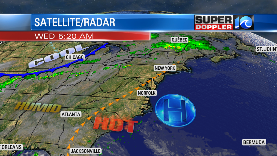
We’ll have lots of sun today. There will only be a stray shower or storm in the region. High temps will rise into the low-mid 90s. However, the heat index will be near 100 degrees.
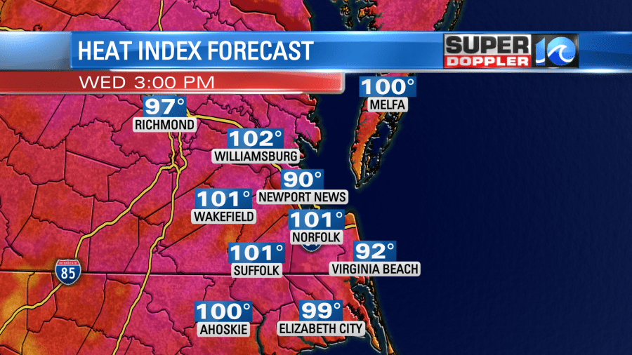
It’s not record heat. The record high temperatures are in the low 100s. However, it is above average. The average highs are in the upper 80s this time of year. Also, the heat is much worse in the northeast states and the western U.S. Portland Oregon just hit their all time high of 116 degrees. Yes… that’s the Portland in the northwestern U.S. That is some crazy heat for that region.
Around here we will cool down on Friday. A cold front will slowly sink into the region through the day. We’ll have some showers and storms ahead of it in the morning. Then we’ll have some more develop later in the day as the front drops in.
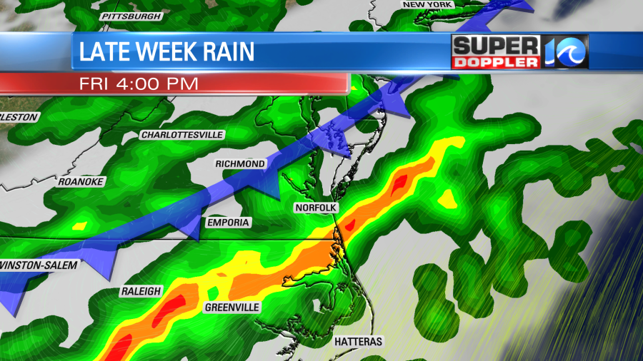
Rain may be heavy at times. A few strong storms will also be possible. High temps will be knocked down into the low-mid 80s. However, the humidity won’t drop until the end of the day.
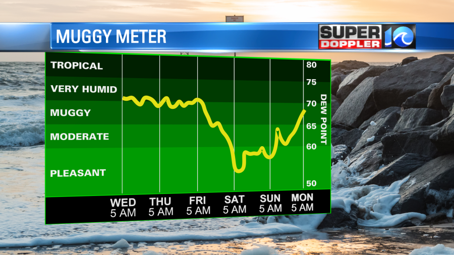
The good news is that the 4th of July weekend is looking good. High temps will be in the 80s both Saturday and Sunday. Humidity won’t be too bad. Also…after a few showers early Saturday morning we will have a pretty quiet weekend. I’m optimistic about any fireworks Sunday night, but cautiously optimistic.
We’ll be quiet and hotter on Monday. Highs will be in the 90s.
The tropics have been very busy for the early season (as they have been for the past few years). We actually had tropical storm Danny briefly affect the coast of South Carolina a couple of days ago. That’s already gone. However, there is a new area that we are watching over the central Atlantic. There are 2 tropical disturbances there, but the one that is farther to the southeast is looking stronger overall.
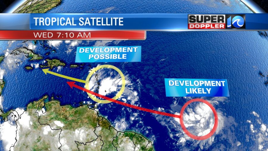
This feature has a medium to high chance of formation over the next few days. It will likely affect the Lesser Antilles. Possibly Cuba after that. Some models then have it eventually turning north towards the southeastern U.S. We’ll see. I’ll have more details on that in tomorrow’s weather blog.
Meteorologist: Jeremy Wheeler


