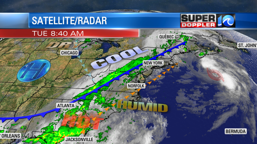
When I got into work this morning it felt like a sauna. It was about 80 degrees with high humidity. A cold front is slowly sinking to the southeast today. It will run into this region of high humidity, and that will lead to some heavy downpours later this afternoon.

As the front drops in it will change the winds and drop the temperatures. We’ll be in the mid 80s around noon. Then temps will drop to the mid-upper 70s this afternoon. Winds will shift from the southwest to out of the north. There will be some wind gusts to 25mph. A few higher gusts will be possible in the stronger storms. The heavy rain will also act to drop the temps.
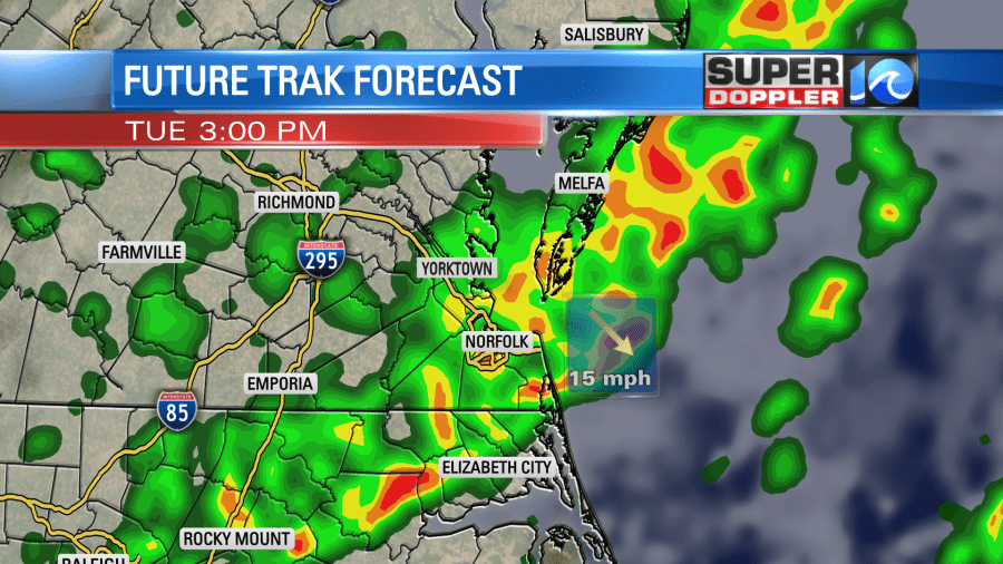
Localized flooding will be possible. Scattered heavy showers will be possible by noon, but there will be a bigger line of showers and storms during the afternoon near the front.

The showers and storms will continue into the early evening, but the threat for heavy rain will drop to the south by then. The rain will taper off later this evening. Then we’ll only have some isolated showers late tonight into early tomorrow morning. Rain totals will vary widely. Some locations could see a quarter to a half an inch. Some isolated areas could get 1-2″ of rain in a short period of time.
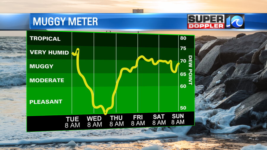
Tomorrow we’ll dry out nicely. Dew points will drop from the 70s to the 50s.

We’ll be partly cloudy most of the day. High temps on Wednesday will be in the upper 70s. We’ll be cool and dry on Thursday with highs in the upper 70s. We’ll be warmer by next weekend with the higher humidity returning. There will be a a few showers and storms each day, but no day looks like a washout.
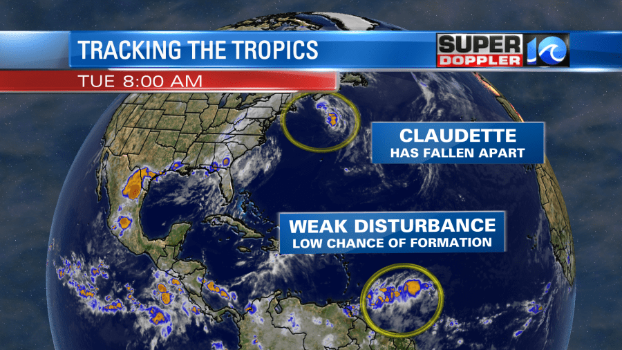
In the tropics… Tropical storm Claudette has fallen apart over the north Atlantic. There is a new/weak tropical disturbance that is east of the northern coast of South America.

This feature has a low chance for development as it moves generally west/northwest. We’ll track it over the next couple of days.
Before I go… I found a neat article a couple of weeks ago, but I haven’t had a chance to post it. Every heard of “blood glaciers” or “watermelon snow”? It is when snow turns pink or reddish due to algae blooms. This is a phenomenon in the Alps that has happened for many years. However, it has become a lot more common recently. Mostly likely due to climate change. Here is the article with more information: Blood Glaciers.
Meteorologist: Jeremy Wheeler


