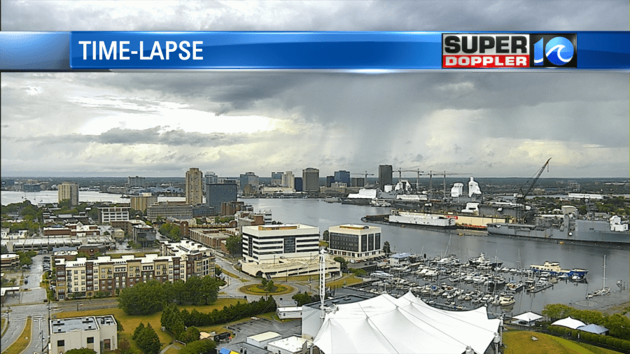
Holy Humidity Batman! If you looked out the window this morning, then you pretty much could see the thick moisture streaming into the area from the south. There was a cool capture of a rain shaft as well.
A warm front started lifting into the region overnight. There were a few heavy showers, and this continued into the morning commute.
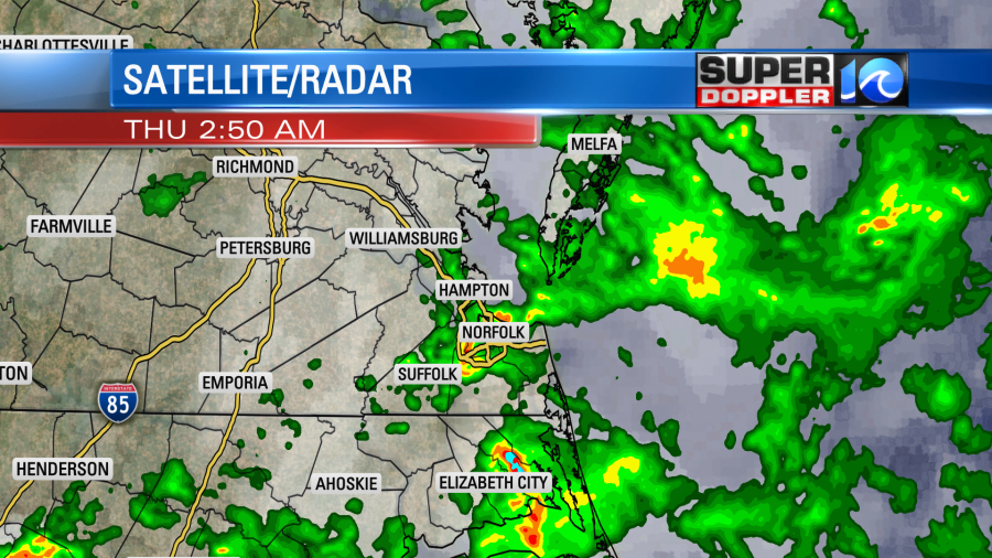
The warm front will lift northward through the day. We’ll be in the warm/humid zone all day. There is a cool front creeping closer to us form the west, but it won’t arrive until tomorrow. High pressure is offshore.
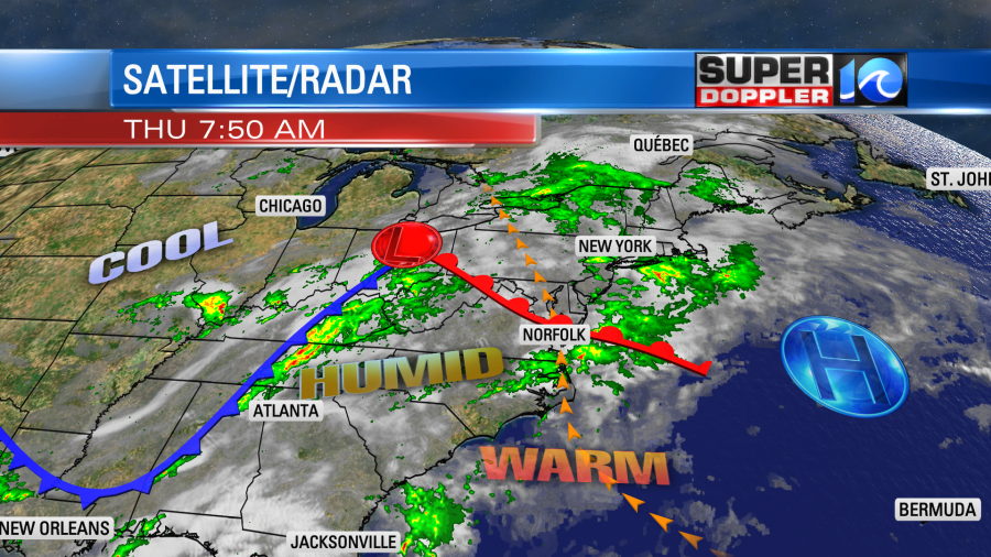
Winds will be out of the south at 10-15mph through the day. This will keep feeding in warm/muggy air. We’ll have lots of clouds along with the rain, but high temps will still manage to reach the upper 70s and low 80s.
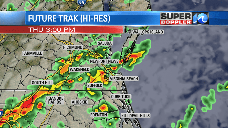
As we warm up this afternoon there will be a potential for some strong thunderstorms.
We have a marginal risk for strong to severe storms over most of the area. We are on the edge of a slight risk which extends to the northwest.
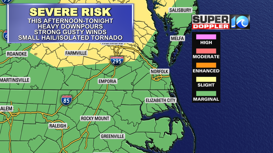
There is some upper level wind support (shear) over the area along with warm/unstable air. However, the thick cloud cover could limit how severe the storms become. Regardless, I think heavy downpours will be likely with or without some sun.
We’ll have some more scattered showers and storms tonight. Then early tomorrow morning the models show a bigger area of rain coming through the region.
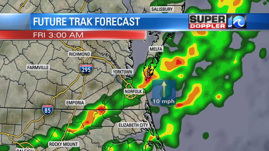
This could impact part of the morning commute. The cool front won’t move in until late in the day. We’ll have some scattered showers and storms through the day, but it won’t be a washout. We’ll have a few showers later tomorrow as the front finally arrives. High temps will be in the 80s.
Before the rain wraps up we could get 1-3″ of rain over the region. I am siding with the RPM and GFS models this time around for the rainfall forecast.
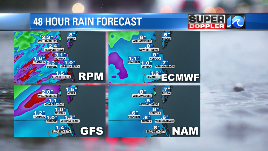
There is a potential for at least some localized flooding today, tonight, or tomorrow. Therefore, there is a Flash Flood Watch for parts of northeast North Carolina into southeast Virginia.
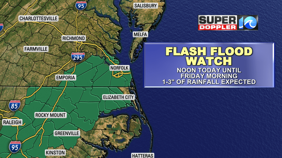
This goes from noon today until tomorrow morning. Keep in mind that some cities and counties could be added to the map later today.
The area will finally dry out (A Bit) tomorrow night into Saturday. It will still be humid over the weekend, but not as bad as the next 36 hours.
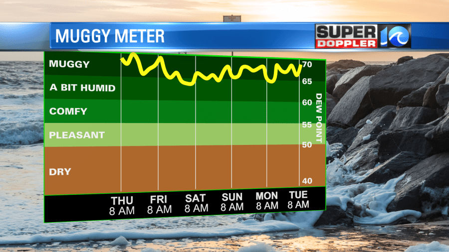
The great news is that the weekend forecast is looking good. We’ll be partly cloudy both days with highs temps in the mid-upper 80s. It will be fairly humid too. It should be some great beach weather!
Meteorologist: Jeremy Wheeler

